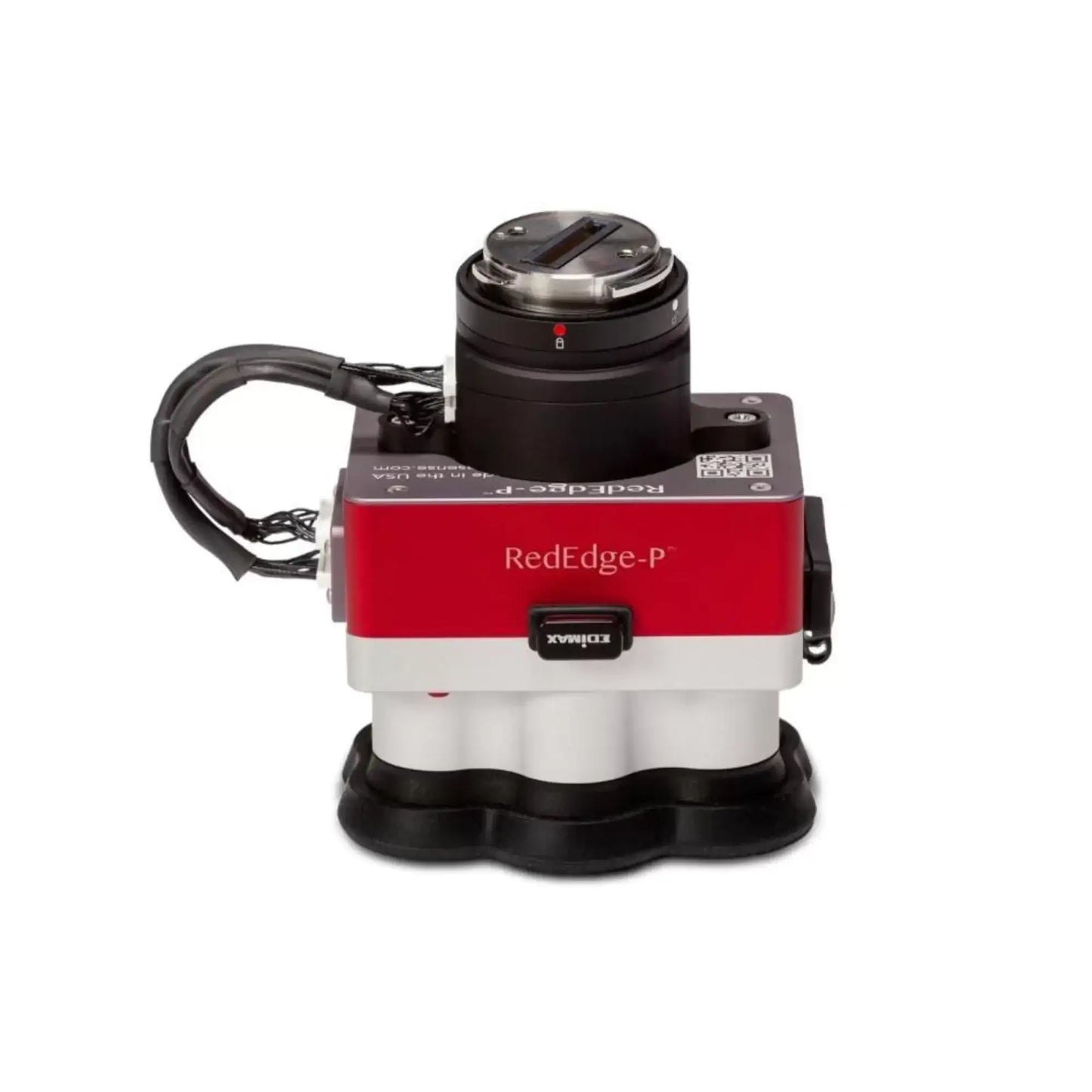
MicaSense RedEdge-P: Advanced Multispectral Imaging Sensor with DJI Skyport
Take your aerial imaging to a whole new level with the MicaSense RedEdge-P with DJI Skyport. This single-camera solution captures calibrated high-resolution multispectral and RGB images, and its optimized Field of View (FOV) and capture rate ensure efficient flights. You'll enjoy crisp, pan-sharpened RGB and multispectral outputs at a phenomenal 2-cm GSD from an altitude of 60m!
The RedEdge-P is specifically designed with seamless interoperability in mind — it's easy to integrate with DJI SkyPort-compatible drones such as the Matrice 300, Matrice 200 V1 & V2, and Matrice 210 V1 & V2. Even better? This integration enables RTK capabilities when you use the M300 drone!
For superior aerial imagery with amazing detail, look no further than the powerful MicaSense RedEdge-P with DJI Skyport. Get up in the skies today and experience clearer vision for yourself!
What the MicaSense RedEdge-P Brings to Your Drone
High-resolution multispectral and panchromatic imagery
Captures five multispectral bands (blue, green, red, red edge, near-infrared) along with a high-resolution panchromatic band to create detailed, accurate images with enhanced spatial resolution.
Global shutter for distortion-free images
Equipped with a global shutter that ensures high-quality images even during fast-moving flights or with aircraft vibrations.
Seamless integration with drones
Compatible with a wide range of UAV platforms. Features multiple interfaces, including Ethernet, serial, and PWM/GPIO trigger, allowing for easy integration with most flight controllers.
Advanced light sensor (DLS 2)
The Downwelling Light Sensor measures ambient light conditions and sun angle during flights, automatically adjusting image captures to compensate for changes in lighting.
Durable and lightweight design
Compact at just 315g (including DLS 2 and Wi-Fi module) with a rugged build, designed for reliability and endurance in demanding environments.
Flexible power options
Can draw power from a variety of sources including the aircraft’s main battery pack or a separate rechargeable battery.
Real-time data access
Features built-in Wi-Fi and an Ethernet port for easy connectivity, real-time image capture, and data download during or after the flight.
API support for custom integration
Supports HTTP and serial APIs (MAVLink protocol) for advanced users looking to integrate the sensor into more complex systems or workflows.
MicaSense RedEdge-P In Action
Precision Agriculture: Farmers and agronomists use the RedEdge-P to monitor crop health, identify plant stress, and optimize resource allocation. The sensor’s multispectral capabilities allow for early detection of problems like disease or drought, enabling targeted interventions that improve yields and reduce costs.
Forestry Management: The RedEdge-P is essential for forestry professionals who need to assess forest health, monitor tree growth, and detect deforestation or pest outbreaks. With its high-resolution imagery, the sensor helps track changes over time, providing invaluable data for sustainable forest management.
Environmental Conservation: Ecologists and environmental researchers utilize the RedEdge-P to map and monitor natural habitats, track biodiversity, and assess the impact of environmental changes. Its ability to capture detailed, multispectral data supports conservation efforts and provides insight into ecosystem health.
Mining and Geology: The RedEdge-P is used in the mining industry for exploration and site monitoring. By analyzing multispectral data, geologists can detect mineral signatures, assess soil composition, and monitor land changes during excavation processes.
Urban Planning and Development: Urban planners use the RedEdge-P to map green spaces, monitor urban sprawl, and assess environmental impacts of development. Its high-resolution imagery provides detailed views of landscapes, aiding in more informed decision-making.
Archaeology: The sensor’s ability to capture multispectral images has made it valuable in archaeological surveys. It helps detect subtle differences in vegetation and soil composition that indicate the presence of underground ruins or artifacts, aiding in the discovery of hidden historical sites.
Disaster Response and Recovery: In the aftermath of natural disasters, the RedEdge-P supports emergency teams by providing clear, detailed aerial imagery for damage assessment and recovery planning. Its data can help prioritize areas in need of immediate attention, enhancing the efficiency of disaster relief efforts.
Why Choose Dronefly for Your Drone Needs?
When you shop at Dronefly, you’re getting high-quality drone products, service and support:
-
Professional Guidance: Our knowledgeable drone specialists are here to assist you with any questions you have about drone models, parts, or accessories.
-
Swift and Secure Delivery: We pride ourselves on fast shipping, ensuring your items arrive promptly and safely, no matter where you are.
-
Certified Vendor: As an authorized dealer for top drone brands, we guarantee authentic products backed by full manufacturer warranties.
Specifications
-
External Power: 7.0 V - 25.2 V
-
Power Input: 5.5/7.0/10W (Standby, average, peak)
-
Sensor Resolution: 1456 x 1088 (1.6MP per MS band) | 2464 x 2056 (5.1MP panchromatic band)
-
Spectral Bands: Blue, green, red, red edge, near-IR (global shutter, narrowband)
-
Wavelength (nm): Blue (475nm center, 32nm bandwidth) | Green (560nm center, 27nm bandwidth) | Red (668nm center, 14nm bandwidth) | Red edge (717nm center, 12nm bandwidth) | Near-IR (842nm center, 57nm bandwidth)
-
RGB Color Output: 5.1MP (Global shutter, aligned with all bands)
-
Ground Sample Distance (GSD): 7.7cm per pixel (per MS band) at -400' (120m) AGL | 3.98cm per pixel (panchromatic band) at -400' (120m) AGL
-
Capture Rate: Up to 3 captures per second raw DNG
-
Interfaces: 3 Configurable GPIO: select from trigger input, PPS input, PPS output, and top of frame signals. Host virtual button. USB 2.0 port for WiFi. Serial. 10/100/1000 Ethernet. CF Express for storage
-
Field of View: 50 Degree HFOV x 38 Degree VFOV (MS) | 44 Degree HFOV x 38 Degree VFOV (PAN)
-
Storage: CFexpress Card
-
Dimensions: 3.5 x 2.8 x 2.6" (8.9 x 7 x 6.7cm)
-
Weight: 12.8 oz (363g)
In the Box
- RedEdge-P sensor
- DLS 2 with embedded GPS
- Calibrated Reflectance Panel (CRP 2)
- USB WiFi dongle
- Lens cover
- Necessary integration cables
- DJI Skyport for M300
- CFexpress card
- CFexpress card reader
- Hard Carrying Case
- Quick StartGuide

