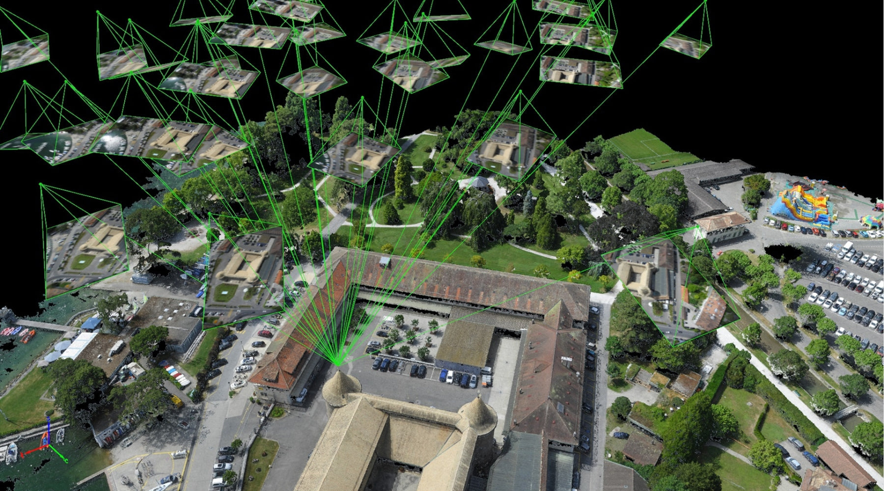
Pix4D Drone Software
PIX4D offers a comprehensive photogrammetry software suite for drone mapping—capture images with their app, process them on desktop or cloud, and create detailed maps and 3D models.
-
PIX4Dcloud
Regular price From $59.00Regular priceUnit price / per -
PIX4Dfields
Regular price From $330.00Regular priceUnit price / per -
PIX4Dmapper
Regular price From $370.00Regular priceUnit price / per -
PIX4Dmatic
Regular price From $350.00Regular priceUnit price / per -
PIX4Dreact
Regular price From $450.00Regular priceUnit price / per -
PIX4Dsurvey
Regular price From $150.00Regular priceUnit price / per
Harness the potential of drone surveying and mapping with Pix4D software
Seize the full power of your drone using Pix4D software. This incredibly powerful suite of tools can be applied in a variety of industries and applications, from deep agricultural analysis to efficient emergency response mapping.
Everything that professionals need to open up their drone mapping and surveying possibilities is here in Pix4D.
Main Pix4D Software Solutions
Pix4Dmapper
- The core application of Pix4D is that photogrammetry tool which is suitable for survey, construction, and estate surveying of an accurately dimensioned project through drone images.
Pix4Dmatic
- This software is ideal for a large-scale project, as it involves the processing of big amounts of data, thus fitting the needs of construction, mining, and urban planning.
- It correctly creates maps and models, even for extensive areas.
Pix4Dfields
- It focuses on agriculture as an application and offers a field with detailed insight into the health of crops and their optimization yield.
- It enables the farmer and agronomist to monitor the conditions of crops, aid in detecting diseases early, among other decisions.
Pix4Dcloud
- It assists teams to gain data access and work easily; hence, it delivers online mapping and 3D modeling with it.
- It's more effective for construction purposes, real estate, and town planning with easy sharing and decision-making .
Pix4Dsurvey
- Pix4Dsurvey fills the gap between traditional surveying and drone photogrammetry.
- Thus, surveyors and engineers can efficiently extract and digitize terrain data while also including drone data in their workflows with least effort.
Pix4Dreact
- Pix4Dreact is only that tool which does fast and dynamic 2D mapping in emergency response situations.
- For first responders, humanitarian organizations, and public safety professionals, this tool is undoubtedly indispensable for having reliable and quick data for immediate decisions.
Industries Utilized by Pix4D Drone Mapping and Surveying
Pix4D drone mapping and surveying solutions are meant to find a place in any industry. Pix4D offers special tools for special applications.
Construction and Urban Planning
- Monitor project progress, plan developments, and document site conditions with detailed maps and 3D models.
Agriculture
- Use Pix4Dfields to assess crop health, optimize yields, and manage resources efficiently.
Surveying and Civil Engineering
- Create accurate terrain maps and integrate drone data into existing workflows for improved project outcomes.
Emergency Response
- Use Pix4Dreact for rapid situation assessments, helping teams make informed decisions quickly.
Mining
- Measure stockpiles, map sites, and conduct safety inspections with Pix4Dmatic, ensuring accurate and efficient operations.
Environmental Monitoring
- Track changes in landscapes and ecosystems over time, supporting environmental research and conservation efforts.
Why Choose Pix4D Software with Dronefly?
As an official Pix4D partner, Dronefly is dedicated to providing you with cutting-edge drone mapping and surveying solutions.
By choosing Pix4D software through Dronefly, you gain access to:
Professional Advice:
- Our team helps you select the right software to match your specific needs and applications.
Tailored Solutions:
- We offer customized solutions that integrate seamlessly into your existing operations, maximizing the value of your investment.
Ongoing Support:
- Benefit from our expert support and guidance to ensure you get the most out of your Pix4D software.
Embrace the Future of Drone Surveying and Mapping with Pix4D Software
Take your drone surveying and mapping to the next level with Pix4D software and Dronefly. Whether you want to boost agricultural productivity, streamline construction projects, or respond effectively to emergencies, Pix4D has a solution for you.
Explore our offerings today and transform your operations with the power of Pix4D drone mapping and surveying technology.
Contact us to learn more and take the first step towards enhancing your workflow with innovative drone software.


