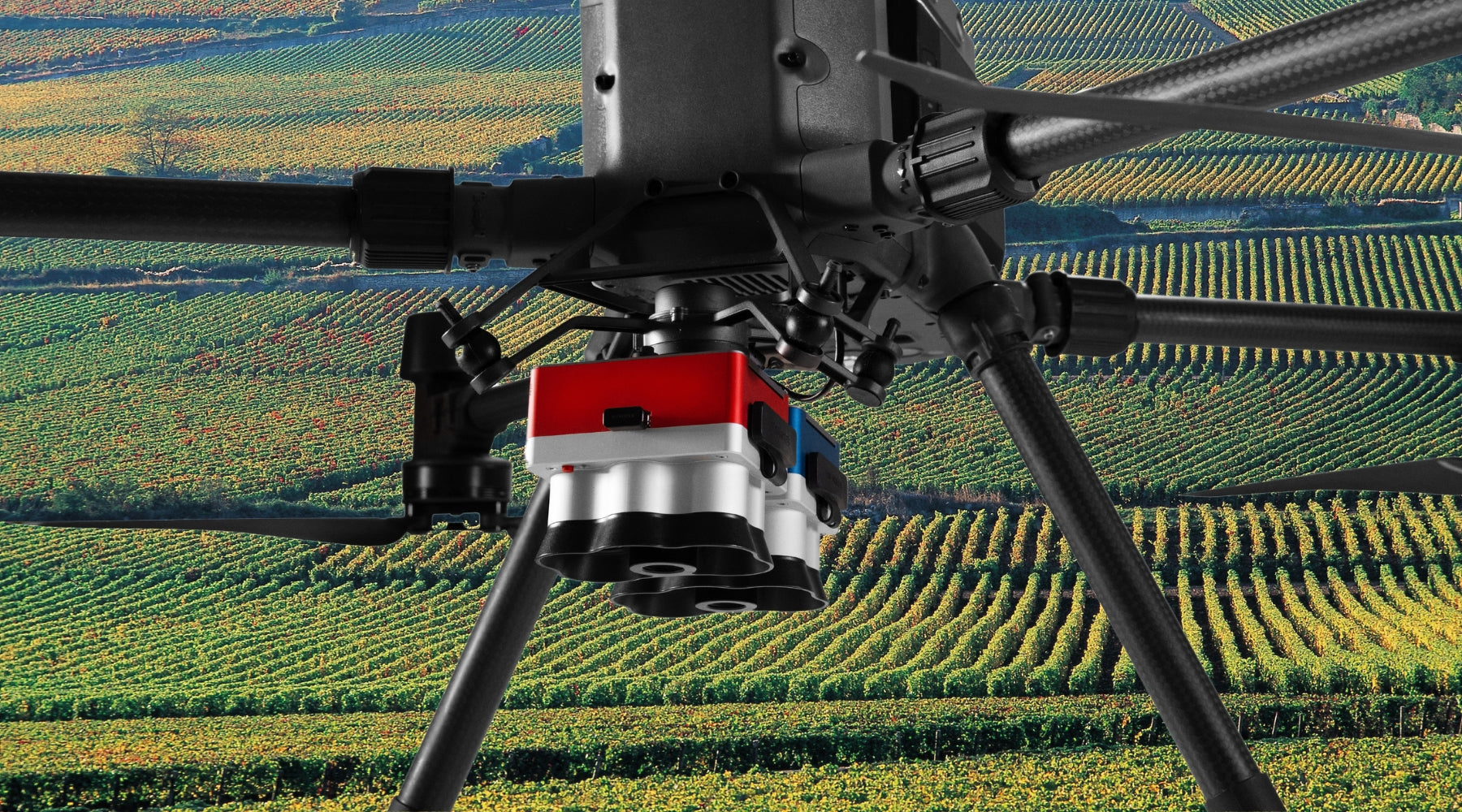
Micasense RedEdge-P
The Micasense RedEdge-P delivers high-resolution multispectral and RGB imaging in one flight, perfect for precision agriculture and environmental monitoring, with 2cm GSD from 60m and efficient flight capabilities.
-
Micasense RedEdge-P
Regular price $7,995.00Regular priceUnit price / per -
Micasense RedEdge-P Blue Multispectral kit
Regular price $8,995.00Regular priceUnit price / per -
Micasense RedEdge-P Blue Multispectral kit with DJI Skyport
Regular price $10,995.00Regular priceUnit price / per -
Micasense RedEdge-P Dual Multispectral kit
Regular price $15,995.00Regular priceUnit price / per -
Micasense RedEdge-P Dual Multispectral upgrade kit (for current users of RedEdge-P)
Regular price $8,995.00Regular priceUnit price / per -
Micasense RedEdge-P with DJI Skyport
Regular price $8,999.00Regular priceUnit price / per$9,995.00Sale price $8,999.00Sale -
Micasense RedEdge-P with DJI Skyport
Regular price $8,999.00Regular priceUnit price / per$9,995.00Sale price $8,999.00Sale -
PPK activation license Micasense Red Edge-P
Regular price $6,300.00Regular priceUnit price / per
Micasense RedEdge-P Overview
The Micasense RedEdge-P marks a significant advancement in multispectral technology, providing a unified camera system capable of capturing both high-resolution multispectral and RGB imagery in perfect harmony. This device is crafted for precision and efficiency, boasting an enhanced field of view (FOV) and capture rate. It is the ideal choice for high-quality aerial imaging required by professionals.
Key features and benefits
- High-Resolution Imaging: The RedEdge-P is equipped with a high-resolution imager for all colors, designed to produce sharp RGB and multispectral outputs. It achieves a ground sample distance (GSD) of 2 cm from 60 meters altitude, enabling detailed monitoring and analysis.
- Efficient Flights: Thanks to its optimized FOV and capture rate, the RedEdge-P allows for more efficient flight missions. This means broader area coverage in less time spent flying.
- Seamless Integration: Compatibility with the DJI M300 through the RedEdge-P SkyPort adapter ensures easy integration and enables RTK capabilities for better positioning accuracy.
Technical specifications
- Synchronized Multispectral and RGB Capture: The RedEdge-P synchronizes data collection efforts, capturing calibrated imagery across various spectral bands and RGB in a single mission.
- Optimized FOV and Capture Rate: Its design focuses on operational efficiency, with an optimized FOV and capture rate that support quick and extensive area scanning.
- 2cm GSD from 60m: The RedEdge-P captures high-resolution imagery at 2cm GSD from a height of 60 meters, providing exceptional detail.
What's included in the sensor kit
The Micasense RedEdge-P sensor kit comes with everything needed for sophisticated aerial imaging:
- RedEdge-P Sensor: Your main tool for high-resolution multispectral and RGB imaging.
- SkyPort Adapter: For effortless integration with the DJI M300, enabling RTK capabilities.
- Lens Cover: Protects the sensor's lens during transport and storage.
- CFexpress Storage: Offers fast data transfer and large storage capacity.
- Calibrated Reflectance Panel (CRP 2): Facilitates accurate data calibration.
- DLS 2 Light Sensor with Integrated GPS: Improves imagery accuracy through light calibration and geotagging.
- Accessories: Includes cables, mounting screws, a hard carrying case, and a DLS2 mast kit for complete setup and deployment.
The Micasense RedEdge-P is a groundbreaking instrument for professionals who aim to harness the power of advanced aerial imaging. With its superior resolution capabilities, efficient flight performance, and seamless drone integration, the RedEdge-P is a prime choice for applications in precision agriculture, environmental monitoring, and a wide array of remote sensing tasks.
Micasense RedEdge-P Dual Multispectral
The MicaSense RedEdge-P Dual Multispectral Kit pushes the boundaries of aerial imaging, providing insights into vegetation and environmental research with unparalleled detail. Featuring 10 spectral bands, including a unique coastal blue band and a panchromatic band for improved resolution, this dual-camera system delivers data comparable to that of Landsat and Sentinel satellites but with higher resolution. It is specifically designed for professionals in fields such as agriculture, environmental research, and analysis of water bodies.
Benefits at a glance
- Enhanced Data Comparison: Offers satellite-like imagery at a higher resolution, ideal for environmental research, agriculture, and analyzing water bodies.
- Advanced Monitoring: The coastal blue band allows for the monitoring of shallow waters, while narrow bands enable precise plant health analysis.
- Reliable Analysis: Dual calibration with the DLS light sensor and CRP reflectance panel ensures accurate data under different lighting, supporting time-series analysis and AI applications like crop counting.
- High Resolution: Provides a GSD of 2 cm per pixel from 60m, enabling the early detection of issues and informed decision-making.
- Efficiency and Compatibility: Captures up to three images per second with a 128 GB CFexpress card and ensures compatibility with the DJI Matrice 300 and various software through an open API.
- Comprehensive Insights: Generates multiple outputs and indexes, such as RGB, NDVI, NDRE, for insights beyond human vision.
Accessories included
- DLS Light Sensor: For accurate ambient light and sun angle measurement.
- CRP Reflectance Panel: Offers a radiometric calibration tool for precise data adjustment.
Applications
The MicaSense RedEdge-P Dual Multispectral Kit serves a broad range of applications, from analyzing vegetation in water bodies to habitat monitoring and species identification, proving invaluable in environmental monitoring, water management, and agricultural insights.
Proudly made in the USA, MicaSense sensors are relied upon by academic, private, and governmental institutions globally, providing a solid solution for detailed environmental and vegetation analysis.
Shop MicaSense RedEdge-P at Dronefly
Discover the advanced capabilities of the Micasense RedEdge-P for your professional aerial imaging needs at Dronefly. Elevate your precision agriculture, environmental monitoring, and remote sensing projects with our state-of-the-art multispectral technology. Visit Dronefly.com today to explore how the RedEdge-P can transform your aerial data collection, offering unmatched efficiency and insight. Join the ranks of industry professionals who trust Dronefly for their advanced imaging solutions – your journey to superior aerial imaging begins here.


